-
geological and hydrogeological activities
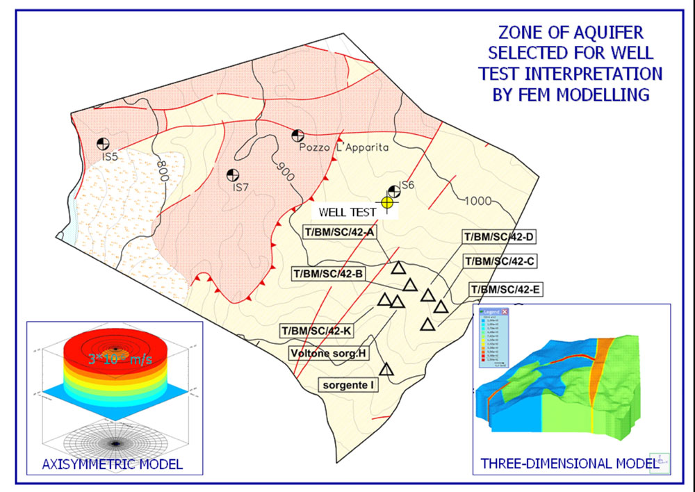
regional planning, qualification and quantification of underground and superficial natural resources, design of civil and mining works
-
surveys
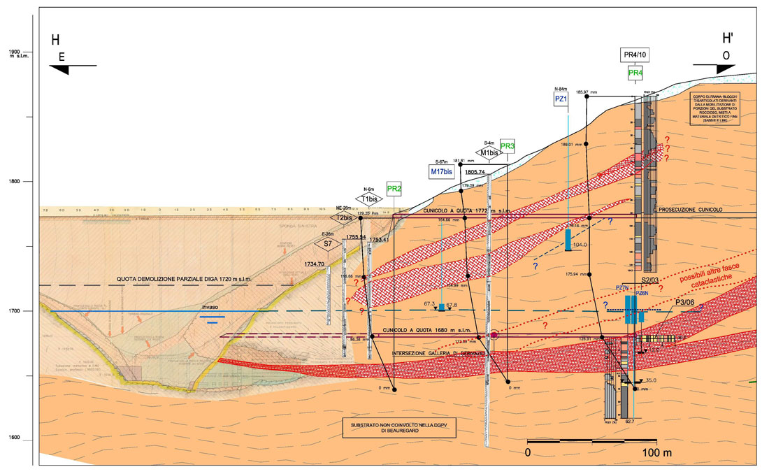
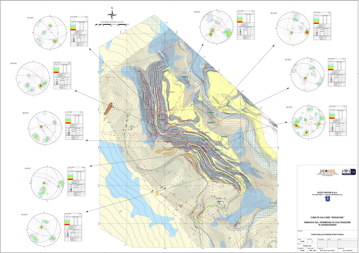
geomorphological surface surveys, geostructural and hydrogeological surveys on surface and underground
-
data processing
processing and interpretation of the data collected for the reconstruction of the reference geological model
-
environmental impact
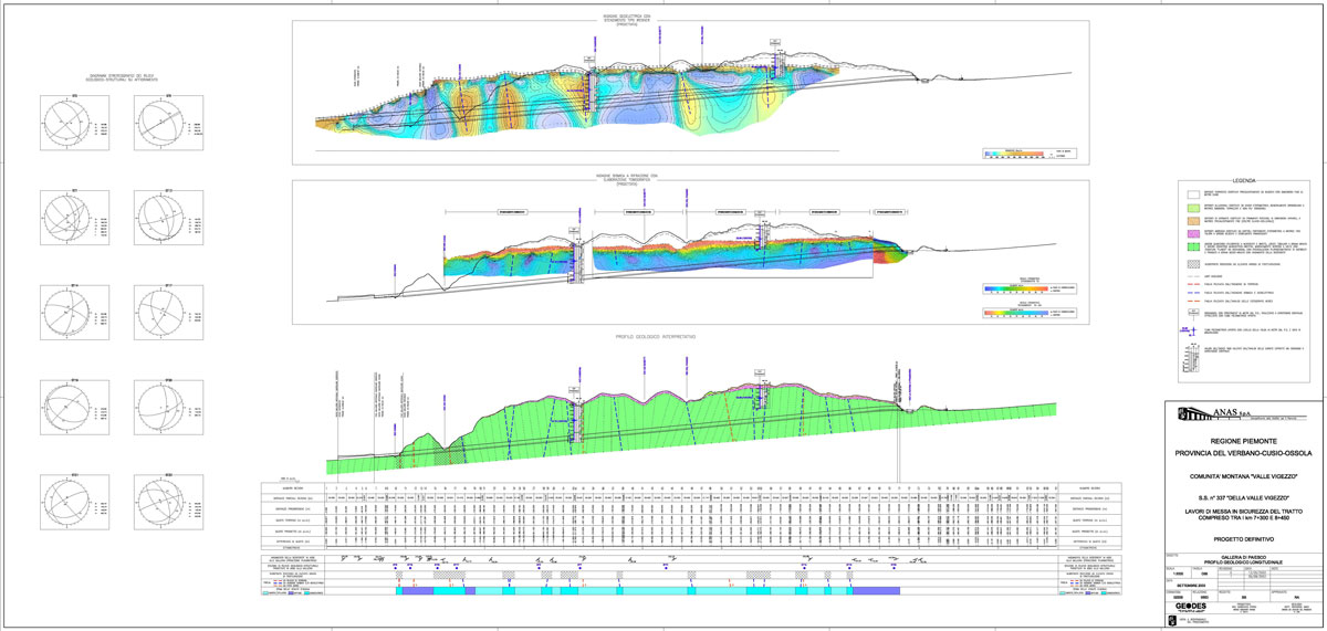
development of environmental impact studies
-
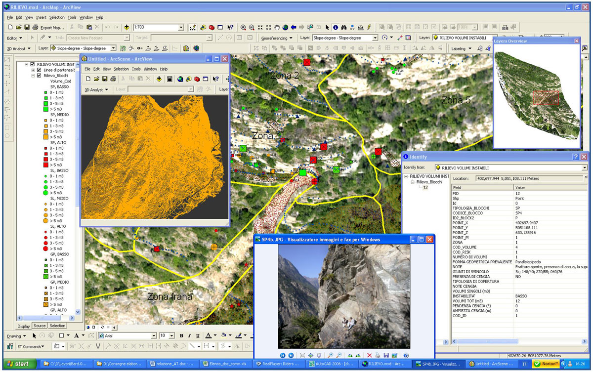
geographic information systems
implementation of geographic information systems with reference to land planning and management issues
-
databases
creation and management of GIS digital cartography
-
risk analysis
execution of hydrogeological risk analysis
-
work supervision
work supervision services and technical assistance for geognostic investigations